Utility Mapping
5 Day PAS128 Utility Mapping and Surveying Course: Advanced Training for Utility Surveyors
Five intensive days. Every PAS128 survey level from D through to B. Advanced electromagnetic and GPR training delivered by the most experienced utility mapping trainers and assessors in the UK. With a written exam and full practical assessment, this is the course that turns competent locators into confident surveyors.
5 Days
Intensive classroom and site training
3 Venue Options
Wigan, Worcester or your own site
TSA, ICES & EUSR Approved
Mapped to ICES competencies for Utility Mapping
What This Course Covers
The Full PAS128 Surveyor Programme
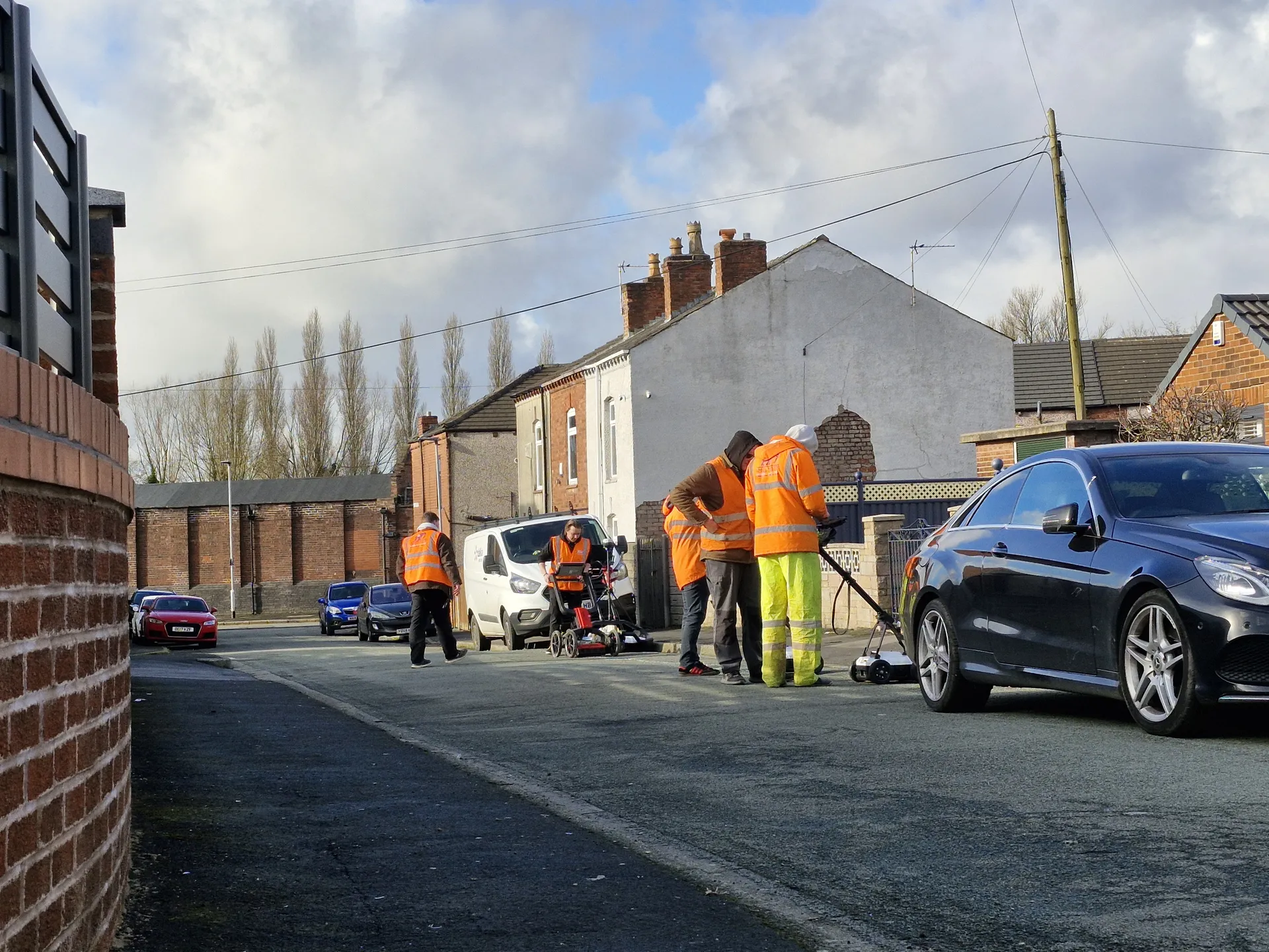
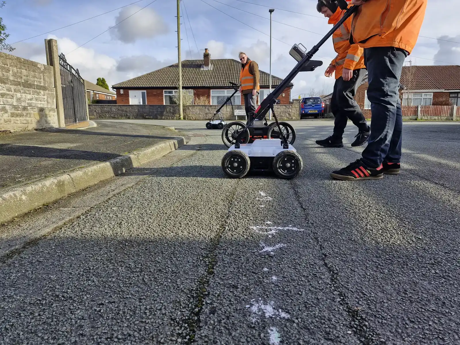
Most underground utility location training focuses on a single piece of equipment or a single task. The 5 Day PAS128 Utility Mapping and Surveying Course does something different. Over five days, delegates work through every aspect of a compliant utility survey: from desktop research and site reconnaissance through to electromagnetic location and full ground penetrating radar operation, culminating in a two-man practical assessment on a real survey site.
The course covers PAS128 Survey Levels D and C in Module 1, PAS128 Level B electromagnetic detection in Modules 2A and 2B, and PAS128 Level B GPR in Module 3. On Day 5, delegates complete both a full practical operational test and a formal written exam.
It is the only course of this scope delivered by a provider with this depth of real-world utility mapping experience. Every Sygma trainer is a practising or former utility mapping professional, not a career trainer reading from a spec. The course content goes beyond the minimum requirements at every stage.
Course at a Glance
Audience
Designed For
| Who | Why |
|---|---|
| Utility surveyors entering the profession | A thorough foundation in PAS128 processes from Day 1 |
| Experienced locators moving into mapping and surveying | Formalises and extends existing site skills to surveyor level |
| Self-employed contractors building their service offering | Recognised accreditation supporting client confidence |
| Utility mapping company employees | Structured training aligned to ICES competencies and ProQual pathways |
| Delegates pursuing ProQual Level 3, 4 or 5 qualifications | This course fulfils evidence requirements for Level 4 and 5 and includes an optional Level 3 add-on |
If you are new to the industry and do not have a workplace mentor, additional practical sessions are available throughout the year on demand. Contact the bookings team for details.
Course Structure
Five Days of Structured, Progressive Training
Each day builds on the last. By Day 5, delegates have the knowledge and practical experience to conduct a full PAS128-compliant utility survey using all detection methods.
Day 1
Utility Networks, STATS Plans and Site Reconnaissance
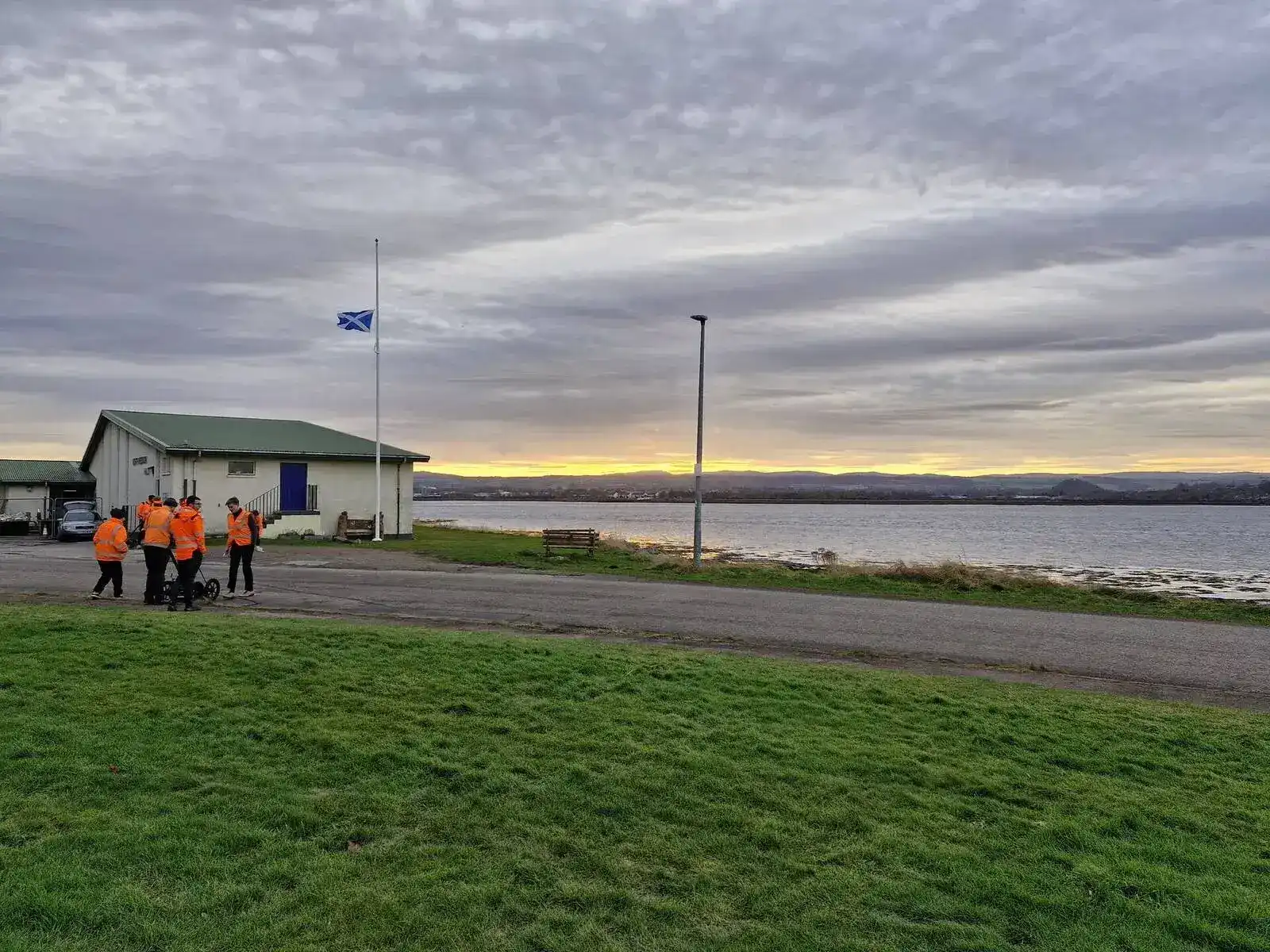
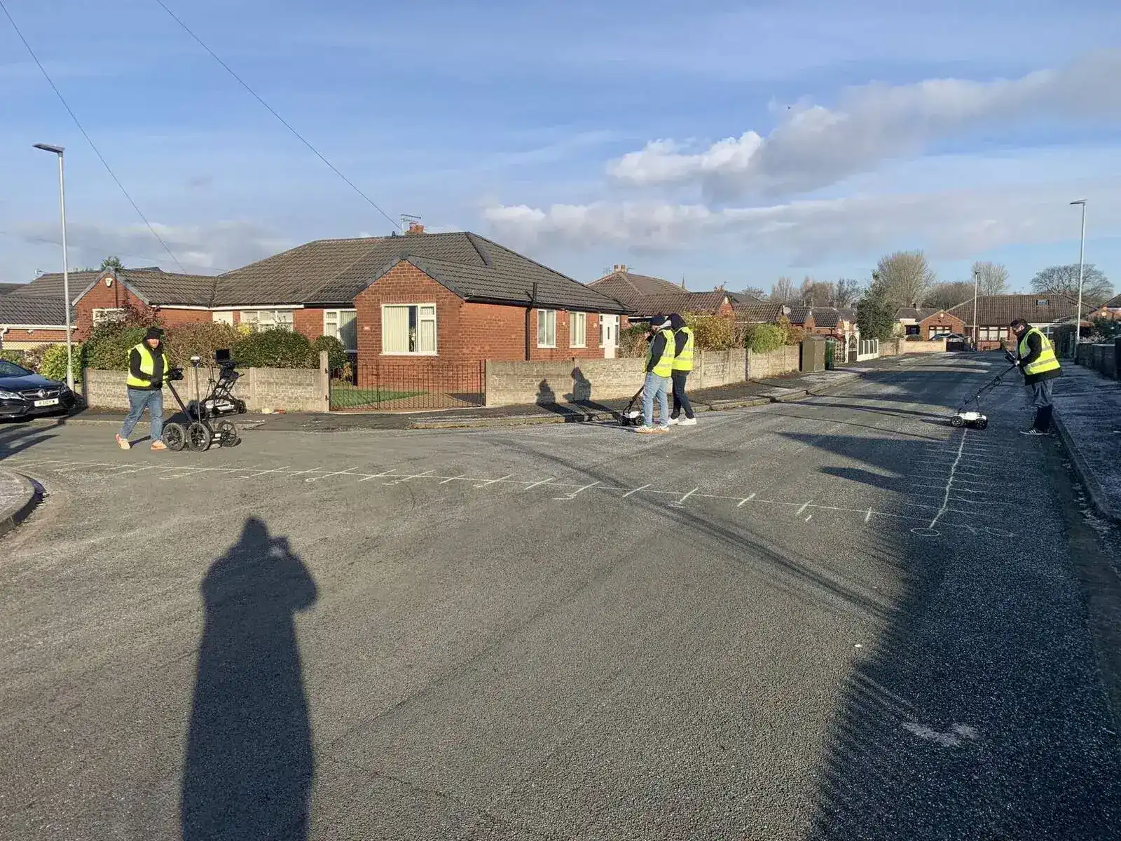
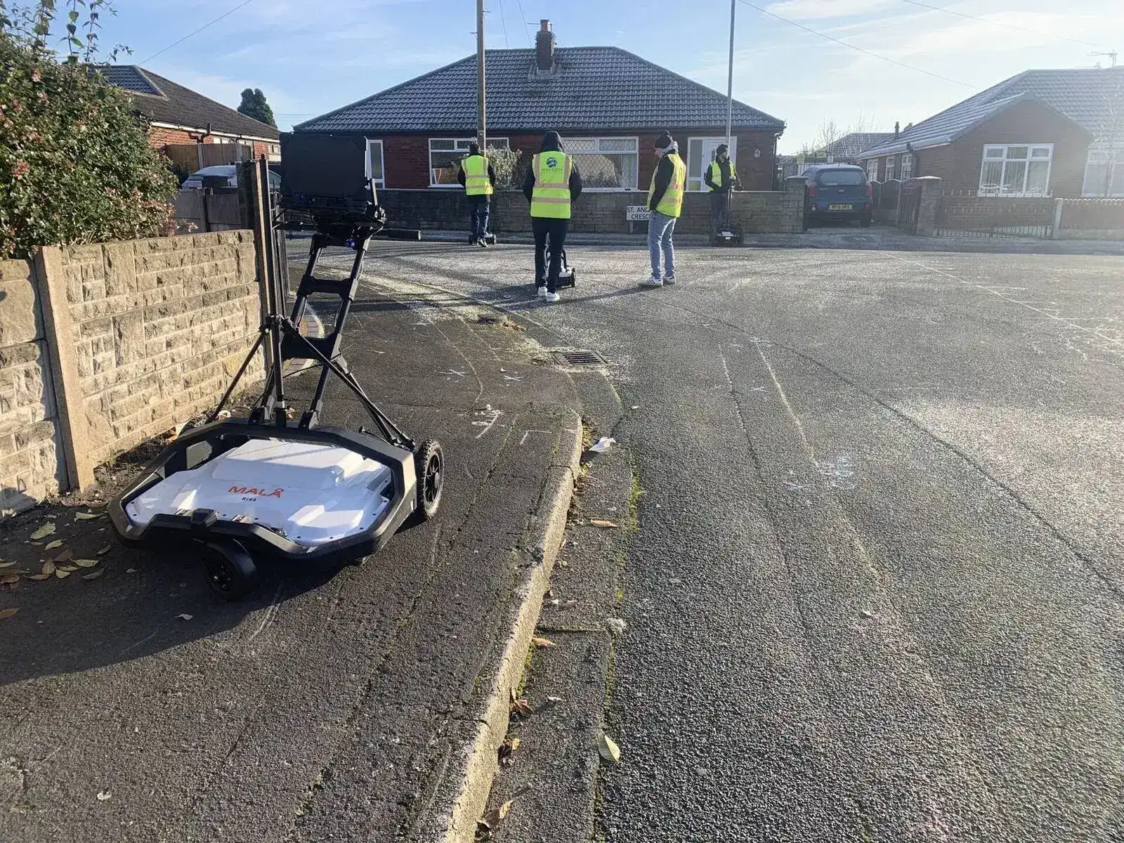
Mix of classroom and site activity from Day 1. This is not a passive course.
Day 2
Electrical Theory, EM Theory and Legislation
Day 3
Advanced EM Locating with Radiodetection 8000 Series and Vivax vLoc Pro 3
Day 4
GPR Theory and Operation
Day 5
Assessment Day
Delivery
Three Ways to Book
Open Course
Sygma Solutions Utility Mapping Centre, Wigan
Fixed course dates, open to individuals and small groups. Contact the bookings team to check availability and reserve your place.
Open Course
The Survey School, Worcester
Fixed course dates at The Survey School in Worcester, delivered in partnership with The Survey School. Ideal for delegates in the Midlands, South, and Wales. The Survey School is the UK's leading professional training provider for the land and mapping sector.
Private Course
Your premises or a site of your choice
Arranged to suit your team's schedule and location requirements. Pricing is based on group size, location and any bespoke requirements.
For individuals new to the sector without a workplace mentor, Sygma offers additional practical sessions throughout the year on demand. Speak to the bookings team for availability.
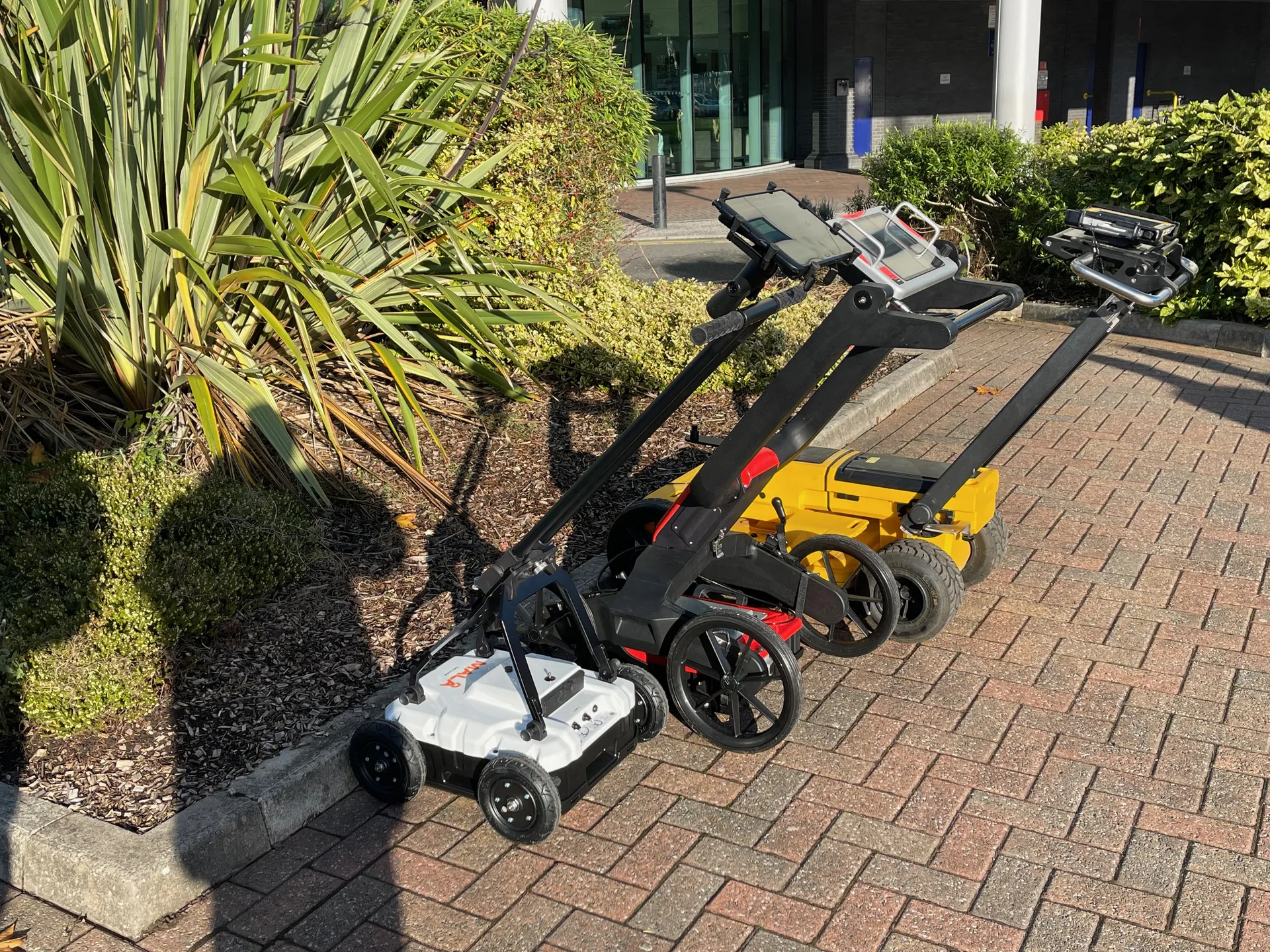
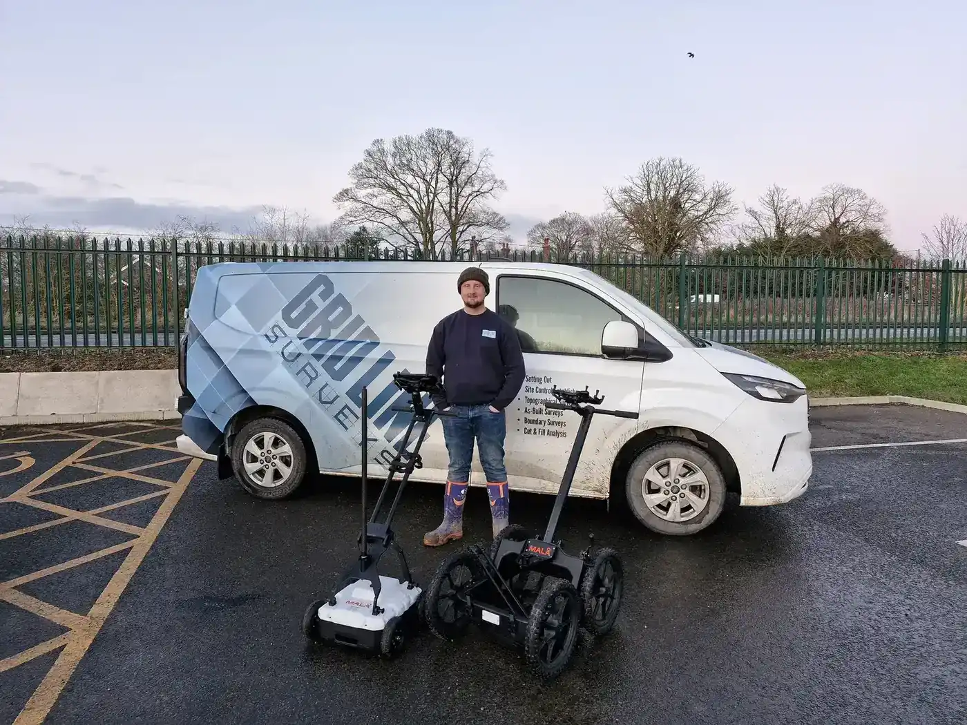
Equipment
Equipment Available on Site
The following equipment is available for delegates to use during the course. Delegates who prefer to use their own equipment or other manufacturers' equipment are welcome to do so (please bring any such equipment from Day 3 onwards).
PPE Requirements
Appropriate PPE for working in quiet roads and footpaths is required throughout the practical elements of the course. Delegates should check specific PPE requirements with the bookings team when confirming their place.
Accreditation
Accreditations and Qualification Pathways
| Accreditation | Detail |
|---|---|
| TSA Approved | Training courses approved by the Survey Association |
| CICES Approved | Mapped to ICES competencies for Utility Mapping |
| EUSR Accredited | Nationally recognised utility sector accreditation |
| ProQual Approved Centre | Assessments conducted in line with nationally recognised ProQual standards |
ProQual Level 3 (Optional Add-On)
The ProQual Level 3 Certificate in Utility Mapping and Surveying is an optional nationally recognised qualification that can be completed alongside the 5 Day course. It enables the CSCS card for utility mapping roles. ProQual assessments are completed on Day 5 alongside the standard course assessment.
Evidence for Level 4 and Level 5
Completion of this course fulfils a number of the evidence requirements for the ProQual Level 4 and Level 5 Utility Mapping Qualifications. Delegates pursuing those higher qualifications can use their assessed work from this course as portfolio evidence.
Assessment
How You Will Be Assessed
The course includes two formal assessments, both completed on Day 5.
Practical Operational Test
Delegates work in two-man teams to survey a small site area using all the detection methods covered during the week: site reconnaissance, EM locating with RD8000 series or vLoc Pro 3, and GPR. A sketch plan of located services and depths must be produced.
Equipment use and methodology is observed throughout, and proof of location must be demonstrated to the examiner. The practical test demonstrates compliance with PAS128 at quality levels B1 to B4 (non-post processing).
Any locatable buried utility not found results in a 2% reduction per occurrence.
Written Exam
A written exam under exam conditions covering both graphical and written questions. An overall pass mark of 70% is required to successfully complete the course.
Successful delegates receive a certificate of course completion confirming that they have passed both the written exam and the practical assessment to PAS128 Level B standard.
Delegates on the ProQual Level 3 add-on receive their ProQual certificate separately upon processing by ProQual.
What You Get
Delivery Team
The Most Experienced Utility Mapping Trainers in the UK
This course is delivered by Sygma's team of directly employed specialist trainers and assessors. They are not career trainers who have read the spec (they are industry practitioners who have applied these techniques on real sites across the UK). Every trainer has worked as a utility surveyor or for an equipment manufacturer before joining Sygma.
Sygma is an independent training provider with no commercial interest in any particular survey company or equipment manufacturer. That independence matters when you are learning the real capabilities and limitations of EM and GPR technology. Delegates receive objective, evidence-based instruction with no commercial agenda.
15+
Directly employed specialist trainers
Every trainer is a former utility surveyor or equipment manufacturer professional. Independent of any equipment manufacturer or survey company.
ICES Framework
Mapped to ICES Competencies for Utility Mapping
This course is approved by TSA and CICES and mapped to the ICES competency framework for utility mapping.
| Module | Content | ICES Competency |
|---|---|---|
| Module 1 | Desktop Survey and Site Reconnaissance (PAS128 Level D & C) | ICES GEUS01 A-D |
| Module 2A | EM Locators Basic Theory (PAS128 Level B (EM)) | - |
| Module 2B | Advanced EM Locating (PAS128 Level B (EM)) | ICES GEUS01 E&G |
| Module 3 | GPR (PAS128 Level B (GPR)) | ICES GEUS01 F Part 1 |
Next Steps
Build on This Course
GPR Training
Standalone or extended GPR training for existing surveyors.
TSA and ICES Utility Mapping Programme
Full 7-module programme for the complete ICES competency framework
ProQual Level 3 Certificate
Nationally recognised qualification (can be added to this course)
ProQual Level 4 Diploma
Next qualification step for working surveyors
PAS128 Awareness
Entry-level PAS128 course for those who procure or interpret surveys
Funding Support
CITB Employer Network
Sygma is a CITB Approved Training Organisation (ATO) and a member of the CITB Employer Network. Employers registered with CITB may be able to access Employer Network funding towards training costs. Contact your CITB adviser or Sygma for guidance on eligibility.
Why Sygma
Why Choose Sygma for the PAS128 Course?
Real Survey Experience
Every trainer is an active PAS128 surveyor, not a classroom instructor. They survey on live sites and understand what works in the field.
Specialist Trainers
Directly employed, TAQA qualified, with backgrounds in utility surveying or equipment manufacturing. Your trainers have done the job.
Five Full Days of Practical
This is the most comprehensive PAS128 course available. Every day includes site work. By Day 5, delegates are ready to survey independently.
Independent and Unbiased
We are not tied to any manufacturer and do not sell equipment. Training reflects what works in practice, not what a supplier wants to sell.
Small Class Sizes
Maximum 8 delegates ensures every delegate receives individual attention during practical assessments and hands-on training.
We Come to You
Private courses delivered at your site with all equipment provided. Travel is included in the course rate.

Common Questions
Frequently Asked Questions
Do I need prior locating experience to attend?
No prior formal training is required. The course starts from first principles on Day 1. That said, delegates who have some experience with electromagnetic locating will find the advanced content on Days 3 and 4 more immediately applicable.
Can I use my own GPR or EM equipment?
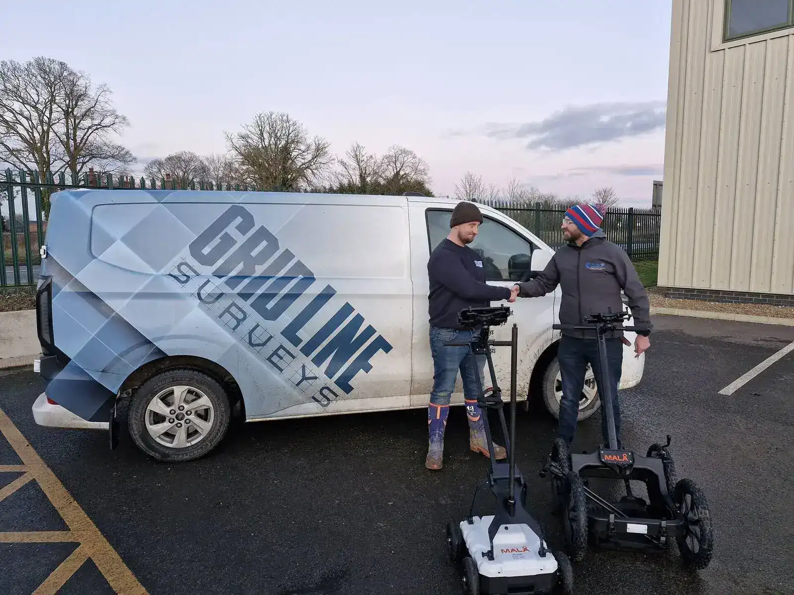
Yes. Radiodetection 8000 series, Vivax vLoc Pro 3, MALA GPR and DS2000 are all available for use on site. If you prefer to train on your own or your company's equipment, please bring it from Day 3 onwards. Let the bookings team know in advance so arrangements can be made.
What is the ProQual Level 3 add-on and do I need it?
The ProQual Level 3 Certificate in Utility Mapping and Surveying is an optional nationally recognised qualification that can be completed alongside the 5 Day course. It enables the CSCS card for utility mapping roles. If you are pursuing the Level 4 or Level 5 qualifications, the Level 3 is part of the pathway.
How does this course count towards Level 4 or Level 5?
The 5 Day course generates assessed evidence that can be used within the ProQual Level 4 and Level 5 portfolios. Speak to the bookings team about how to plan your training pathway.
Is there additional support available for new entrants to the industry?
Yes. If you are new to the sector and do not have a workplace mentor, Sygma offers additional practical sessions throughout the year on demand. These are tailored to where individuals are in their development. Contact the bookings team for details.
What certification do I receive?
Successful delegates receive a certificate of course completion confirming that they have passed both the written exam and the practical assessment to PAS128 Level B standard. Delegates on the ProQual Level 3 add-on receive their ProQual certificate separately upon processing by ProQual.
Enquire About the 5 Day PAS128 Surveyor Course
Open course dates available in Wigan and Worcester throughout the year. Private courses arranged to suit your team. Contact us to check availability, discuss the ProQual Level 3 add-on, or request a quotation.